
More... history
Domesday Survey (1086)
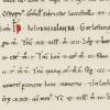
Domesday Lowestoft (1)
The further back in history that any researcher tries to go, the more difficult it is to make progress because of diminishing, usable, documentary sources. This is what makes Domesday Book so valuable.
 - Suffolk Archives (Ipswich), 193/2/1")
Early Modern Lowestoft (Mid 18th Century)
Mid-Late 18th Century Urban Status and Identity
The field of study constituting urban history is both complex and wide-ranging, combining a variety of sources and a number of disciplines. Economic and social history may unite in helping to explain and illuminate a community’s existence and function, but integration with historical geography and demographic features is required in order to produce a deeper understanding of the human activity which created that entity.
, Acc. No. 368.")
Fishing and Maritime Trade (Late 16th-Early18th Century)
Introduction
First of all, reference has to be made to the geographical advantages of Lowestoft’s position on the East Coast. A substantial number of its male inhabitants made a living from going to sea, while others remained on shore and earned money from processing catches of fish and handling other cargoes. A select minority of these latter even grew wealthy through maritime activity, because they were the people who owned the vessels which caught herrings and cod or which carried merchandise of different kinds.

Fishing Seasons, Catching Methods & Curing (Mid 16th-Early 18th Century)
The Cod Voyages
The spring and early summer sailing to Faeroe and Iceland from East Coast ports (line-fishing for cod and ling) may have begun as early as the beginning of the 15th century – possibly in the Scarborough area – and was a well-established feature by the start of the 16th. Lowestoft’s involvement is proven, but it is not possible to say how many vessels were regularly involved and over what sequence of years they were sent.
Historic Lowestoft Fires (1645, 1670, 1717 & 1780)
One of the things most dreaded during the Late Medieval and Early Modern periods, in townships of any size with a concentrated nucleus of houses and other buildings, was fire. And so, it can do no harm to start by giving an account of the most disastrous fire to have occurred in Lowestoft throughout throughout the whole of its recorded history.

House Design and Interior Arrangements (16th-18th Century)
Construction details
In May 1545, the Duke of Norfolk was carrying out a review of coastal defences between Great Yarmouth and Orford because of a perceived invasion threat from France. Having commented on the hostile landing capacity of both anchorage and beach at Lowestoft, as well as on the positioning of the three small gun batteries, he made the following remark concerning the place itself: “The town is as pretty a town as I know any few on the sea coasts, and as thrifty and honest people in the same, and right well builded.” – ref.

Inventory of Josiah Wilde (1656) – Probate Record
Original spelling and layout have been adopted throughout for authenticity and reader interest, but square-bracketed monetary values added to assist readability. The reason for using Roman numerals to give values is not known.
, showing rod-and-line angling in progress. The tower of Kirkley Church is visible in the distance. View taken from the Isaac Gillngwater collection of illustrations (c. 1807) - Suffolk Archives (Ipswich), 193/2/1.")
Freshwater Fishery (Late 16th-mid 17th Century)
The large expanse of water on Lowestoft parish’s southern boundary provided a freshwater fishery for coarse fish, which had nothing to do with the town’s commercial sea-fishing activities. The mere was always referred to as the Great Water or the Fresh Water during the 16th,17th and 18th centuries (and probably before that, as well) – later becoming known as Lake Lothing during the earlier part of the 19th.

Good Cross Chapel (Late 13th-Late 18th Century?)
The foundation called the Good Cross Chapel is a lesser-known part of Lowestoft’s religious history, which once stood in the extreme south-eastern corner of the parish near the junction of the present-day Suffolk Road with Battery Green Road – possibly in the location of what is now the Fish Market entrance.

Great Plague of Lowestoft (1603)
Many readers will know know something of London’s so-called “Great Plague”, which began in May 1665 and stretched into January 1666, and in which an estimated 100,000 people may have died out of a population of 350,000-400,000. A total of 68,596 burials is accounted for in parish records, but so intense was the rate of death from July to September that many people’s burials went unrecorded.

Hearth Tax of 1674
Hearth Tax, as a means of raising money for The Crown, was introduced into England following the Restoration of the Monarchy under Charles II in 1660. It functioned on the principle of being a wealth tax, in that the number of fire-places in a house was taken as indicating the affluence of the occupant. The greater the number of rooms heated, the richer that householder was assumed to be – either as owner or renter.

Hundred Roll of 1274-5
When Henry III died in November 1272, his son and successor Edward (thirty-three years old) was in Sicily, on the way home from fighting in the Seventh – and last – Crusade. A hardened warrior of many years experience, it wasn’t until the year 1274 that he finally reached England to take up his throne, with the coronation being held in Westminster Abbey on 19 August. He went on to subjugate Wales, invade Scotland (becoming known as “the Hammer of the Scots”) and generally impose his presence on all around him – his impressive height of 6’ 2” gaining him the nickname of “Longshanks”.
 - a modern construction of a 14th century Hanseatic cog, found buried in the River Weser’s mud in 1962.")
Illegal Goings-on in Kirkley Roads (14th & 15th Centuries)
Introduction
Great Yarmouth’s attempted dominance of Lowestoft and control of the latter’s trade only came to an end during the second half of the 17th century, when its legally backed dominance was ended and the Suffolk town placed beyond its jurisdiction.

Inventory of Elizabeth Pacy (1682) – Probate Record
An Inventory of all and singular the goods and chattels, rights and credits, of Elizabeth Pacy late of Lowestoft in the county of Suffolk, widow, deceased, valued and apprized by John Wilde, Henry Warde, Samuel Smyth, John Aldred, John Fowler and James Pacy the 18th day of August Anno. Dm. 1682 as followeth vizt.

Lay Subsidy (1327)
The national tax levied in 1327 to raise revenue for the Crown came at a troubled time for the country, for this was the year in which Edward II was deposed by his wife, Isabella, and her lover, Roger Mortimer, Earl of March – ostensibly, in favour of the future Edward III, who was a fourteen-year-old minor. It was also a time of conflict with Scotland, with an army from north of the border making an incursion into England and engaging with English forces near Stanhope, in County Durham.

Lay Subsidy (1524-5) – Part 1
The Lay Subsidy of 1524-5 (1) see also (2)
This national taxation measure was approved by Parliament in 1523, to raise money for war to be waged with France and Scotland (who else!), and with a hoped for total of £800,000 as its aim. As with previous countrywide levies, it was based on the value of lands held and rented out (where this was the major source of income), on movable goods (where these served the same purpose) and on wages for men of labouring or servant status.

Lay Subsidy (1524-5) – Part 2
Comparisons of Lowestoft with other Suffolk communities
Suffolk’s Top 25 Townships (1524-5 Lay Subsidy) (2) see also (1)
Order by wealth
Lay Subsidy (1568)
Authorisation for this Elizabethan taxation was granted by Parliament on 18 December 1566 and the official date of collection was 24 February 1568. Lowestoft’s stated contribution of £34 19s 8d was 47% of the Lothingland total of £74 8s 6d and its 112 tax-payers constituted 42% of the half-hundred’s contributors (267 in number). These figures confirm the town’s dominant position in its local area, just as those of the 1524-5 collection did over forty years earlier. The 1568 Subsidy was structured differently from its predecessor in the way that the assessment was made.

Local Fishing Industry (c. 1910-60) Tape-recording Index
Tape-recordings made 1976-83
The recordings were made with local people, with the intention of producing a sound archive to record an important part of the Lowestoft area’s industrial and maritime history. They form the basis of six published works: The Driftermen (Reading, 1978), The Trawlermen (Reading. 1979), Living From the Sea (Reading, 1982), Following the Fishing (Newton Abbot, 1987), Fishing Talk (Cromer, 2014) and The Last Haul (Lowestoft, 2020).

Lowestoft Almshouses (c. 1464-1964)
The first almshouses in Lowestoft were provided by John Manyngham, the parish vicar from 1457-78. The exact year of institution is not known, but they were located on the north side of Fair Lane (now Dove Street) near its junction with West Lane (now Jubilee Way). And they seem to have remained in operation, in some form – undoubtedly with alterations made – into the final quarter of the 19th century, when White’s Directory of Suffolk (1874), p.

Lowestoft and Akethorp (1086-1955)
Lowestoft
The Domesday Survey details (1086) relating to these two communities have been presented and examined in another article, so there is nothing to be gained from repeating what was said there. What can be usefully done, by way of follow-up, is to look at what is known of their function during the centuries following on from William I’s great audit of his realm and reveal something of their manorial status and history.

Lowestoft Market and Fairs (1308-1890)
When the Lowestoft township relocated itself onto the cliff-top during the first half of the 14th century, it had considerations to take account of other than the demands created by its inhabitants’ domestic requirements (these being mainly concerned with the terracing of the cliff to make it usable, the laying out of house-plots and a road system, and the management of the scores to give access to the beach and Denes).

Lowestoft Porcelain: Aspects of Origins, Factory & Workforce (1757-c. 1800)
CREDIT: Ivan Bunn and David Butcher
Origins
This article is in its original form, with minor alterations. It was published (with editorial adjustments and changes) in English Ceramic Circle Transactions, vol. 21 (2010), forming pp. 49-74 of that journal.
 - ink-and-wash study by Richard Powles, present in the Isaac Gillingwater collection of local illustrations (c. 1807) - Suffolk Archives, Ipswich (Acc. No. 193/2/1).")
Lowestoft Religious Affiliation (1560-1790)
When Elizabeth I acceded to the English throne in November 1558, she had a number of problems facing her – not the least of which was the matter of what the country’s official brand of the Christian Faith was to be and what form it was to take.
. Allin’s ship, the “Plymouth”, is shown flying its red flag below his right hand. Samuel Pepys. saw the overall work of portraiture under way in Lely’s studio during April 1666")
Lowestoft’s Famous Five (Naval Heroes – 17th-18th Century)
17th & 18th Century Naval Commanders
It is a claim – not made lightly by this writer – that no town of its size, in the whole of England, produced as many eminent top-rank Naval commanders as Lowestoft did between 1660 and c. 1720. During that time, no less than four admirals and five captains came from five local families mainly involved in fishing and maritime trade: the Allins, the Arnolds, the Ashbys, the Leakes and the Mighells.
 - Suffolk Archives (Ipswich), 193/2/1.")
Maritime Trade and the Granting of Port Status (1679)
Formal recognition of Lowestoft’s status as a trading port might never have been given in 1679, had the town not managed to free itself from Great Yarmouth’s claim to control all maritime traffic in local waters – especially that connected with the herring trade. Articles relating to this long-running and contentious issue are to be found elsewhere in LO&N’s History pages (The Lothingland-Lowestoft-GreatYarnouth Disputes (Parts 1 & 2) and a summative comment can be added to this.
 - Suffolk Archives, Ipswich - 193/2/1.")
Manorial courts of Lothingland Half-hundred (Mid-16th to mid-18th Century)
Mid-16th to Mid-18th Century
The Manorial System served both as the foundation of land ownership and management and of maintaining the peace and good order of each local community. It had its origins in Early Medieval times (what was formerly known as the Anglo-Saxon period) and was further shaped and developed following the Norman Conquest – which is now taken as being the start of the Late Medieval era.

Missing Brasses of St. Margaret’s Church (1645)
During the period of the two English Civil Wars (1642-46 and 1648) - and both earlier and later on - parish churches up and down the length of the land were visited by authorised (and, in some cases, unauthorised) local inspectors whose task it was to ensure that the worship being carried out was both simple and unadorned, in line with Puritan taste and leanings and free of the “High Church” ritual and practice associated with King Charles I and the Archbishop of Canterbury, William Laud, who was executed for treason by Parliament in January 1645.

Muster Roll (1584)
The national Muster Roll of 16 January 1584 (1583, by Julian Calendar reckoning) was a head-count of all adult males in England between the ages of sixteen and sixty, taking into account their military capability in terms of the weapons they held. It was carried out in anticipation of a possible Spanish invasion, launched across the North Sea from the occupied Netherlands (see Lothingland Invasion Scare of 1584,elsewhere, in the History pages of LO&N).
 - once forming part of Lowestoft’s soft, rural, western edge. The southern sector, between Dove Street and St. Peter’s Street, formed Goose Green. The northern part was the town’s Fairstead - Dove Street itself once being known as Fair Lane")
Nature of Farming in Lowestoft (17th & 18th Century)
The type of agriculture practised in Lowestoft during the Early Modern era was of mixed variety, as was the case with most other communities in lowland England. And it was not only mixed in combining crops and livestock; it was also mixed in the sense that many of the people who farmed the land had other interests. It is unfortunate that the two key documents which reveal so much about conduct of agriculture in the parish stand in isolation from each other.

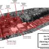
North Denes Liver Trench (1600s & 1700s)
- A large, filled-in trench is visible on the North Denes, a little to the east of the net-drying spars. Its presence is indicated by a slight depression in the ground and by the vegetation growing along its length. The latter is much lusher and of a different type from what is to be found on The Denes generally, showing that the trench’s infill is of a different type from the soil around it.
- The dimensions of this feature were originally eighty to ninety paces in length, on a north-south alignment, and c.
Occupied Ground Space – Nos. 5-25 High Street Plots (1600s to 1700s)
Nos. 5 -25 High Street
Nos. 26-33 are part of an overall sequence of town properties (1-271, in all) showing their transfer, as recorded in the manor court minute books.
They relate specifically to what once occupied the land later taken up by Nos. 5-25 High Street.
Extracted in this form from The Town of Lowestoft c. 1720-25: People and Property in a Pre-Industrial Coastal Community (Lowestoft Heritage Workshop Centre, 2019).

Recorded Immigration Into Lowestoft (1436-1544)
Much is heard today regarding illegal immigration into the UK from across the English Channel and occasionally the North Sea - most of it driven by difficult and dangerous conditions in the particular home countries of origin or by the perceived opportunity to start a more financially rewarding lifestyle than is possible in those same nations.
, executed by Richard Powles in 1782. This was the town’s multi-purpose civic HQ until the Town Hall was built (1857-60). Suffolk Archives (Ipswich), 193/2/1 - the Isaac Gillingwater collection of illustrations.")
Regulation of the Lowestoft Community (1550-1750)
The Governors and Governed in Early Modern Times
In the absence of research relating to felony, and with ecclesiastical court records left largely unexplored, the leet court business in Lowestoft (see Manorial Governance) will be used as indicator of attitudes towards the regulation of local society. There were two differing views of the role of the Law current in pre-industrial England, expressed by James Sharpe in Crime in Early Modern England, 1550-1750 (1984), p. 143.
 at the time of his decease in 1636. The image used here shows the building before its dressed-flint facade was covered with unsuitable white masonry paint, many years ago.")
Accounts of the Administration of Thomas Mighells (1636-9)
This fascinating document records settlement of the estate of a leading Lowestoft merchant, whose burial was recorded in the parish registers on 18 September 1636. It is located within the pages of the Lowestoft Tithe Accounts book (Norfolk Record Office, 589/80) – placed there by the Revd. John Tanner (Vicar of the parish, 1708-59), who had married into a branch of the Mighells family on 20 January 1713 (1712, by Julian Calendar dating) and who probably found the document among existing family papers. He obviously noticed, in the second set of accounts, that burial within the walls of St.
, bounded by Rotterdam Road on the west and crossed by Church Road. It was once a grazing area for the town’s milk cattle, referred to as “the common cow pasture of Lowestoft”")
Animal Husbandry in Lowestoft (17th & 18th century)
Cattle
The amount of grassland of one kind or another revealed in the 1618 Manor Roll (about 170 acres), when compared with that discernible in the 18thcentury Tithe Accounts (about sixty-five acres of permanent pasture, or meadow, and an annual average of twenty-eight acres of the sown variety) may appear to suggest that fewer cattle were being kept in the parish by 1700 than had been the case one hundred years before.

Founding of Lowestoft as Hluda’s toft (mid-late 500s)
Mid-late 6th century? - Founding of Lowestoft as Hluda’s toft, meaning “the homestead of Hluda” - with Hluda itself translatable as “the loud one”. On the evidence of the layout of ancient tracks and other landscape features, the location was possibly somewhere in the north-eastern sector of what is now Normanston Cemetery.

Name change…(Danish) – late 9th century
869-70 - Township’s name possibly changed to the Scandinavian form of Hloðver’s toft, following the great Danish invasion of these years. For about 100 years, East Anglia was part of the so-called Danelaw and eight of today’s sixteen parishes in Lothingland have place-names which have Scandinavian elements in one way or another.
They are as follows: Ashby, Corton, Flixton, Gunton, Lound, Lowestoft, Oulton and Somerleyton. There is some debate about Ashby, which may have its first element deriving from Old English aesc, meaning “ash tree”.
")
Human Migration into Lowestoft (1696-1735)
In 1662, an Act of Settlement for the Better Relief of the Poor was passed by Parliament – a measure soon to become known as the Act of Settlement and Removal, as it aimed at restricting the movement of people from the parishes where they were living in a state of poverty into ones (nearby or further removed) where they believed that they would be better off.

Let This Be a Warning to You (Quarter Sessions Punishment, late 17th Century)
Quarter Sessions Punishment (Lowestoft)
With so much material being available for study of misdemeanour and nuisance (as shown elsewhere in these LO&N pages, in Manorial Governance), the ability to assess the degree of felony among Lowestoft’s inhabitants is made a great deal more difficult by fewer records and by the difficulty of accessing those that do exist.
")
Lowestoft Listed Buildings – Historic England (15th-19th Century)
The Historic England schedule of Listed buildings for Lowestoft (inc. Kirkley, Pakefield. Oulton Broad, Oulton Village & Gunton)
All Grade II unless otherwise indicated
1. Ormiston Denes Academy (original building), Yarmouth Road.
2. Hillingdon, 24 Gunton Cliff.
3. Park Mansions, 3 & 4 North Parade.
4. Wedgewood Court, 1 & 2 North Parade.
5. Ravine Bridge.
6. Belle Vue Park.
7. Patrol Service memorial (Belle Vue Park).

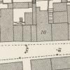
No. 67 High Street (15th-17th Century)
The site of Nos. 64-69 HIGH STREET - occupied by two sets of mid-late 19th century, terraced, triple shop-builds of differing style - was originally one of the largest burgage-plots on the eastern side of the highway (stretching down to Whapload Road) and once occupied by an inn called “The Angel”.
Old Lowestoft – A Case For Heritage Status and Funding (14th – 19th Century)
The High Street area of the modern town is a fine, surviving example of late medieval urban planning, resulting from relocation of the community (between c. 1300-1350) from its original site less than a mile west-south-west of the present one, somewhere in the large municipal cemetery between Normanston Drive and Rotterdam Road. The reasons for the move resulted from a combination of factors.

Old Town of Lowestoft (High Street HAZ – 14th-19th Century)
A paper written in advance of the creation of the High Street HAZ in 2019

The Scores (1582-1756)
A good deal has been written about the scores over the years - not all of it accurate. What follows here is an account of these footways, working from north to south, and looking at them in both a topographical and historical context. The main sources used for the study are a Manor Roll of 1618 (which gives a complete account of landholding in the parish, together with location and tenancy stated) and a series of Manor Court minute books dating from 1582-85 and 1616-1756.

The Gentle Shining of a Lesser Light (1461)
Faith and Duty opposing Earthly Ambition - A Local Story
Introduction

The Cocos Island Treasure Hunt (1935)
[First published as the last chapter in the writer’s book The Last Haul (2020).]
Were you ever down the Congo river?
Blow, boys, blow.
Where the fever makes the white man shiver.
Blow, my bully-boys, blow.
(Traditional American capstan song: Blow, Boys, Blow)

Town Hall Raid (8 May 1933)
“I know not whether laws be right,
Or whether laws be wrong.
All that we know who lie in gaol
Is that the wall is strong;
And that each day is like a year,
A year whose days are long.”
(Oscar Wilde: “The Ballad of Reading Gaol”)
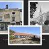
Three Key Buildings: Domestic, Religious & Industrial (14th-19th Century)
In some ways, buildings are every bit as much historical documents as written sources and can inform the observer of many aspects of human activity in days gone by. Where they have survived in original form, they have much to say of former economic and social conditions – be they domestic, ecclesiastical or industrial in nature. And, if altered and converted at different times, there is just as much to be learned from them. Let us take three of Lowestoft’s buildings, covering these three categories, and consider each one of them in turn within its context.