
More... history

Tuttles Tales theatre project
A project funded by the Arts Council is calling on people to share memories of a town's now-closed department store.
Tuttles Tales will examine Tuttles in Lowestoft, Suffolk, which closed in 1981, through personal stories and physical memorabilia.
The stories will be collated to inspire a production of the same name at The Seagull Theatre in March 2024.

£10m multi-use hub Town Hall
A £10m transformation of a former town hall building will bring "social and economic benefit", a council said.
The granting of planning permission means the building in Lowestoft, Suffolk, will become a multi-use hub and will include a cafe, gallery and a community event space. CREDIT: BBC

Football's Role in Wartime
Many professional footballers served in the forces. Those killed in action included Lowestoft's own Ivan Flowers who played for Wolverhampton Wanderers and Mansfield Town. At a local level Abiah Sabberton (who also took part in tug of war), Thomas Chenery were both in the Great Eastern Railway football team. In 1898 Lowestoft football team captain, William Beatton, so impressed the opposing team Aston Villa (FA Cup winners and officially the best team in England) that they asked him to join them!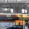
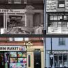
FROM SWAN INN and CROMWELL's HQ
#LowestoftDaysOfChristmas 10th day.. FROM SWAN INN and CROMWELL's HQ to well loved shops in many guises. Nos. 41-42 High Street, as seen today, are replacement buildings for "The Swan" inn, which once occupied the site and served as one of Lowestoft's premier hostelries during the 16th and 17th centuries. It was where Oliver Cromwell stayed overnight on 14 March 1643/44, when he came to Lowestoft (from Cambridge) with a force of cavalry, having heard tell of a shipment of arms either entering or leaving the town (it has never been established which).
The Lowestoft Light re-built again
1670's The Lowestoft Lights were re-built again. A few years previously John Clayton had erected a coal-light a couple of miles north at Corton. Clayton's efforts to build lighthouses at various locations around the coast were seen by Trinity Brethren as being a threat to their monopoly.

Tragedy strikes 4 times
As part of our tribute to those Lowestoft people who died because of two World Wars. We came across 13 Clemence Street - perhaps the most unfortunate wartime address in Lowestoft?

The Christmas Truce 1914
THE CHRISTMAS TRUCE 1914
One famous, and unusual, incident during the First World War was the Christmas Truce of 1914.

Suffolk Histories Meeting
Suffolk Recorders https://slhc.org.uk/recorders/
https://historicengland.org.uk/campaigns/help-write-history/everyday-heritage-grants/
Ipswich zoom meeting Cllr Carole Jones Contact in bury Suffolk sight meeting + newsletter article 2.5k Scanner - business dir idea
Meeting with LADIA
Ambassador event 8th mar John/christine to attend
Skyline Sneak Peek
LowestoftSKYLINE T-07 SNEAK PEEK VIDEO (2 mins)
Hope to see you at our launch NEXT SAYURDAY 13th Jan 11am Get a free ticket below.
https://www.eventbrite.co.uk/e/lowestoft-skyline-tickets-781337089267?a…

High Res Images
#LowestoftSKYLINE T-11 ** High Res Images ** The SKYLINE project will not only show the WHOLE building but it will do so in unprecedented detail. When you click on any building in Skyline view (all in a row), it opens up a page on that building in the architecture section. If you then click on the image on the right of the text (from Historians David Butcher, Ivan Bunn and Heritage England) it will show in full screen 4k Ultra HD resolution (4,000 pixels high) allowing you to explore every detail.

Honey I shrunk the houses
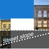
#LowestoftSKYLINE T-14 upcoming online resource to celebrate architecture of historic High St. Having solved the issue of a sloping street, we now had to place each building next to its neighbours, (in Photoshop) and MATCH the scale. Initially we did this by eye to an accuracy of 98%. So was suprised after 30 houses to find that compared to the first in the row it was HALF the size it should be! The Covid pandemic should have taught me all I needed to know about ‘exponential curves’ (R value anyone?). 98% x 98% x 98% x 98%… soon becomes 50%!

12 days West part Two
#LowestoftDaysOfChristmas 12th AND FINAL day.. SKYLINE LOOKUP QUIZ (lower westside) PART TWO here are ANOTHER SIX features. But where are they??? Consider ANOTHER brisk walk to spot them!
The ANSWERS link is in the comments…
and learn more about these lower west side buildings here

Evocative Photos
#LowestoftDaysOfChristmas 9th day.. EMOTIVE PHOTOS. Yesterday's focus on Ernest Tuttle pictured in the Holy Land got me thinking how generous you have all been asking relatives, rummaging through old boxes to provide OurFallen with some evocative, poignant photos - thank you. Here are a few that have caught my eye..
Ernest Crouch in Egypt and Palestine WWI (3 photos)
Stanley Wood - 6th (Cyclist) Battalion (2 photos)
Walter Culham - Royal Horse Artillery served in Mesopotamia (1 photo)
Arthur Sewell - H.M.S. Samphire , west of Algiers (2 photos)

HELP Building details!
#LowestoftDaysOfChristmas 9th day.. We now have architectural and building details on MOST of the buildings on our Historic High Street, thanks to David Butcher and Heritage England. So we are looking forward to launching the SKYLINE project 13/1/24, hope you can join us. But it has highlighted interesting buildings that we know nothing much about! We have raised this with Historic England and they are looking into it but meantime we would like to reach out to the community to see what YOU may know please? Captioned images are below

Missing Pieces Project
Historic England's Missing Pieces Project invites you to share your pictures and stories of the unique, significant and memorable places on the National Heritage List for England (otherwise known as ‘the List’). The List is a register of all nationally protected historic buildings and sites across England.
Your view of a place, including Lowestoft, is as unique as you are, so every snapshot and story you add is an important piece of the picture.
OurFallen near YOU
If you want to get really local you can put in your street or postcode. [more to follow...]
What do over 2000 casualties look like (large file)? As a spreadsheet, it looks interesting. Plot the home address to a street map, and the impact is sobering in its power.
Downhill from here!
#LowestoftSKYLINE Challenge #2 because there is a ground level drop of over 10m between the top of the High street and the bottom, if we positioned each building accurately placing the Town Hall was at ground level (bottom of the screen) then Old Devereux building would be mostly underground! So we need to subtlety adjust each building image to ensure the Skyline page works correctly and makes maximum use of the screen area. This has a knock on effect when sizing each building correctly relative to each other, more on this next week. Launch date Sat 13/1/24

Featured in National Magazine
#ourfallenlowestoft FEATURED IN BBC NATIONAL MAGAZINE! Current issue of “Who Do You Think You Are? Special thanks to Lowestoft Town Council and everyone who has generously shared their photos and memories with us.

Town Hall Challenges and Opportunities
Without doubt, the biggest technical challenge for retrofitting historic buildings, such as Lowestoft Town Hall, is accommodating plant and services. Air-source heat pumps (ASHP) cannot be placed in basements, unlike traditional boilers, as they need air (obviously). They also must be visually and acoustically screened. Read more CREDIT: architectsjournal.co.uk
Stand back!
The first challenge is that many High Street buildings are so tall that even standing the other side of the street it isn’t possible to fit it all in! So as you can see in this example you have to take at an angle and then correct the perspective, add a very wide border to avoid losing any building details!. (Apple Photos > Edit > Crop > Vertical ) Having rechecked its height relative to the adjoining buildings we can then add it into the Skyline project. Only 152 still to do!

Look Up!
#LowestoftSKYLINE! For our next project we are celebrating the wonderful architecture we STILL have in Lowestoft and particularly in the Historic High Street. It is easy to look at a tired shop front and concentrate on what has been lost when if we would only LOOK UP we would see that 95% is still there and worthy of celebration and further investigation. To be launched this January and with wonderful insights written by local historian David Butcher, high resolution photos and links to Historic England. More to follow :-)

Shopfronts Research Report
In 2019 Katie Carmichael wrote a research report on the shopfronts which survive on Lowestoft High Street display elements of styles and materials typical of their time, from the 1840s to the present day, whilst the evidence for lost historic shopfronts helps us to understand the character of the High Street over time.
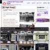
Where Abouts Is...??
A new feature of the website is that from any High Street building page you can see it in the context of where it is in the street, relative to other buildings via a link (RHS or bottom) that takes you to the correct position in our street stroll! e.g. https://lowestoftoldandnow.org/58-high-street#history
It even knows which of the two strolls to show it on, the east side or west side.. clever LOL
best wishes - Joe
")
Cultural or What!
The period of consultation was only 16 days. Get your comments in. See link below.
East Suffolk Council have announced their plans for the Battery Green car park and surrounding area.
The design team are Norwich-based architects Chaplin Farrant and Hemingway Design.
On Wednesday 4th October they presented a small exhibition showcasing the plans for us, the potential users, to examine.
It's not hard to think this is a Good Idea.

Our Fallen Maps
What do over 2000 casualties look like (large file)? As a spreadsheet, it looks interesting. Plot the home address to a street map, and the impact is sobering in its power.
The software we use could not cope with it on a single map without crashing, so we had to slice it into THREE sections.

Jamie's Tree is no different
It's not all that often that we can congratulate local councils.
Lowestoft Town Council has – it seems – listened to people and made some sensible decisions.
They had proposed bringing down the Triangle sails. Contentious, but not outrageous. This has been done.
But they also proposed removing three of the four trees gracing the Triangle. There weren't many in the area who understood this idea. And they complained and objected.

Street Stroll - How?
The Lowestoft Old and Now High Street Stroll
Creating the Stroll is technically quite difficult, and we use several different pieces of software and some specific coding to make it work.
The basic idea is to reproduce a walk along Lowestoft's Historic High Street. Simples, eh.. We wanted to show it as it is, and simultaneously include historical information about the buildings. ( WEST side, EAST side, more )

Historic High Street Goes Digital
PRESS RELEASE
7/11/22
An innovative online project has just gone live on our local webscene.
Supported by Lowestoft Town Council and Woodworks Art Cafe, The Historic High Street Stroll can be found on community website Lowestoft Old and Now –https://lowestoftoldandnow.org/full/stroll
Every building on the High Street appears, including several no longer there!

National Recognition for Lowestoft
'Lowestoft Our Fallen' will feature in the December issue of the Who Do You Think You Are? magazine, the official companion to the successful BBC TV series.
Innovative features of the Our Fallen project include finding 100 casualties who have never before appeared on any memorial and ability to search by postcode (a feature that is already being used by some schools).

Stroll..BOTH sides
A new feature of the site allows you to 'virtually stroll' BOTH sides of the historic High Street at the SAME time! Using the links, you can explore the current shops and buildings OR see them as they were many years ago.

The Scores Walk
The Scores are a series of narrow lanes and steep pathways running from Lowestoft High Street to the site of the town's former beach village. They formed a vital link between the town, which was built on a cliff, and the village, which had developed as a result of the fishing industry. With herring one of the most profitable exports, many workers came to live on the High Street and would have used the scores to go and work in the beach village processing fish.
Old Lowestoft Scores Trail Walk with live map
Name: Old Lowestoft Scores Trail
Difficulty: Hard - several sets of steep steps. Not suitable for mobility scooters, prams, push chairs
Length: 2.5k (1.6 miles)
Terrain: Steps, pavements, paths, crossing roads
Summary: The walk follows most of the Lowestoft Scores (and passes or crosses them all).The map is interactive. Scroll down for text, photos and video clips.

Grand opening of Tram Service
22nd July 1903 Grand opening of the Tramway. Once the system was up and running, there was a seven minute service in operation. 165,900 passengers were carried in the first two weeks.